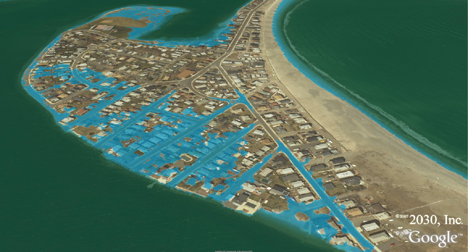
Point Shirley, Winthrop, MA
1 meter rise
1-meter sea level rise
Data Source: MassGIS LIDAR
Maps are based on LIDAR data, USGS 10m NED.
Maps are illustrative; areas in blue depict various potential inundation scenarios.
Map accuracy is dependent on the accuracy of the geospatial data.
Data Source: MassGIS LIDAR
Maps are based on LIDAR data, USGS 10m NED.
Maps are illustrative; areas in blue depict various potential inundation scenarios.
Map accuracy is dependent on the accuracy of the geospatial data.


